
Notas del episodio
Date: August 21, 2025
Current Status and Impacts of Hurricane Erin with Climate Context and Future Outlook
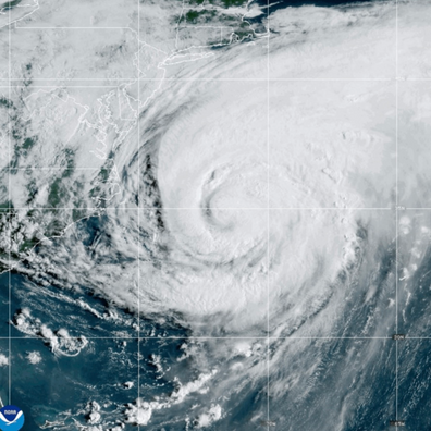
Hurricane Erin, a massive and dangerous Category 2 storm, is currently making its closest approach to the U.S. East Coast after 10 days of churning across the Atlantic. While its trajectory keeps the center offshore, its immense size (a "sprawling 1,000 miles wide," with a tropical-storm-force wind field extending 325 miles from its center) is causing widespread and significant coastal impacts from Florida to Newfoundland, Canada, and will affect Western Europe as a post-tropical cyclone. The storm's rapid intensification from Category 1 to Category 5 within 24 hours (an increase of nearly 85 mph) is highlighted as a direct consequence of human-caused climate change, linking warmer ocean temperatures to increased ...